 By Don Moore
Don’s traveling DX stories can be found in his book Tales of a Vagabond DXer [SWLing Post affiliate link]. If you’ve already read his book and enjoyed it, do Don a favor and leave a review on Amazon.
Fair warning … This article comes with a quiz at the end!
If asked to make a list of major maritime nations, I never would have put Vietnam on the list. It’s not particularly big, and while it does have a long coastline, there are a couple dozen countries with longer ones. But I recently found out that in terms of tonnage, Vietnam has the fourth-largest fishing industry in the world – after China, Indonesia, and India. And that explains something else: why Vietnam has an extensive network of coastal radio stations far greater than would be expected for the country’s modest coastline.
Vietnam’s marine radio network, however, is not easy to hear in Eastern North America. So when I planned my trip to Southeast Asia last winter, my top DX goal was to log all the stations in the network. From November to February, I made SDR spectrum recordings at seven different locations. I did a little DXing of the files while traveling, but it wasn’t until this summer that I had the time to seriously go through them. The spectrum analyzer tool in SDR-Console allowed me to easily find what I was looking for in my many hours of recorded files. Google Translate gave me the means to understand what I was finding. The combination made it possible to DX this network in a way I never would have imagined a few years ago. It’s not just that I made loggings of all the stations. I also gained a deeper understanding of everything the network is doing. It turns out there’s a lot to it, so let’s take a look.
The Duyen Hai Network
The parent organization of this radio network is Vishipel, a Vietnamese government-owned company that provides various services to the fishing and maritime industry. One of Vishipel’s most important responsibilities is the coastal radio station network, known in Vietnamese as the Duyen Hai system. The name is the Vietnamese word for coastal.
Duyen Hai operates twenty-nine coastal radio stations strung along Vietnam’s coast from north to south. Some sources give the number of stations as thirty or thirty-three, but those figures include locations used for satellite monitoring and other support activities. Via California DXer Ron Howard, we have this map showing the network stations.
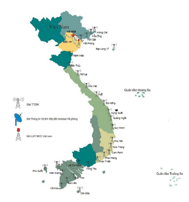
Ron also found this three-page Vietnamese-language PDF file listing the various services and schedules. In the rest of this article I’ll be combining information from the Duyen Hai website, the PDF, the DX Info Centre website https://www.dxinfocentre.com, and my own extensive monitoring.
But first … about spelling. Vietnamese is written using the Latin alphabet but with an extensive system of diacritic marks. It’s far beyond what languages like French and German use and doesn’t always play well with English language websites. For that reason, I’ve omitted the diacritic marks from all the place names and Vietnamese phrases here. But a complete list of everything with the proper Vietnamese spelling can be found in this text file and/or PDF. If you want to put any of these words and phrases into a text-to-speech engine or a translation application, you will have to copy from the text file to get the correct result.
All twenty-nine Duyen Hai stations broadcast scheduled marine weather forecasts twice a day on VHF. Seventeen of those also broadcast the forecasts on 7906 kHz shortwave. Here is a list of those along with the UTC times of the reports on 7906 kHz. Note that three stations also use 8294 kHz. The coordinates are to their antenna sites, per the DX Info Centre website. I’ve reformatted them so they can be pasted directly into Google Maps.
- 2220 & 1020 Kien Giang 9°59’36.0″N 105°05’50.0″E
- 2235 & 1035 Quy Nhon 13°46’40.0″N 109°14’21.0″E
- 2250 & 1050 Hue 16°33’02.0″N 107°38’28.0″E
- 2305 & 1105 Hong Gai 20°57’21.0″N 107°04’07.0″E
- 2320 & 1120 Phu Yen 13°06’22.0″N 109°18’41.0″E
- 2335 & 1135 Ca Mau 9°11’23.0″N 105°08’01.0″E
- 2350 & 1150 Nha Trang 12°13’19.0″N 109°10’50.0″E
- 0005 & 1205 Hai Phong * 20°51’01.0″N 106°44’01.0″E
- 0020 & 1220 Vung Tau 10°23’41.0″N 107°08’44.0″E
- 0035 & 1235 Da Nang * 16°03’17.0″N 108°09’28.0″E
- 0050 & 1250 Ben Thuy 18°48’50.0″N 105°43’07.0″E
- 0105 & 1305 Ho Chi Minh * 10°23’41.0″N 107°08’42.0″E
- 0120 & 1320 Mong Cai 21°31’33.0″N 107°57’59.0″E
- 0135 & 1335 Phan Rang 11°33’51.0″N 109°00’42.0″E
- 0150 & 1350 Phan Thiet 10°55’04.0″N 108°06’22.0″E
- 0205 & 1405 Can Tho 10°04’18.0″N 105°45’32.0″E
- 0405 & 1605 Thanh Hoa 19°20’58.0″N 105°47’36.0″E
* Daily weather also on 8294 kHz
Using Google satellite view and Google Street View, I was able to spot all the antennas except for Hong Gai, where there is no sign of any radio activity. There is a high-voltage power line there, so it doesn’t seem like the best place for an antenna tower. Perhaps the coordinates are wrong, or maybe Hong Gai shares the antenna farm at nearby Hai Phong.
The antenna farms vary greatly in size, from large fields with multiple towers to sites with just a single tower in the back of the building or even on the roof. In terms of how the stations are used and the size of their antenna farms, five are clearly more important than the others: Hai Phong, Da Nang, Nha Trang, Ho Chi Minh, and Vung Tau. The latter two share the same antenna farm in Vung Tau, which is located on the coast at the mouth of the Sai Gon River. The port of Ho Chi Minh, Vietnam’s largest, is forty kilometers upriver.
At Nha Trang I see at least eight towers in this satellite view.
Da Nang has a similar large site. There is a good view of it from the back on Google Street View.
Ca Mau is a mid-sized installation with four towers. Click here to view.
Phu Yen also has four towers. Click here to view.
Phan Rang has a single tall tower behind the station building but zooming in shows several wire antennas. Click here to view.
Quy Nhon has a single tower on top of the building. Click here to view.
The Daily Weather Reports
On a day-to-day basis, the marine weather forecasts are the primary job of the Duyen Hai stations. As noted above, seventeen stations broadcast twice-daily forecasts on 7906 kHz, with three also using 8294 kHz. Sixteen stations are scheduled every fifteen minutes over a four-hour block in the local morning (starting at 2220 UTC) and the local evening (starting at 1020 UTC). The broadcasts begin at five, twenty, thirty-five, and fifty minutes after the hour. A seventeenth station, Thanh Hoa, is outside the regular pattern.
During inclement weather, stations may broadcast additional forecasts, but always at the same time slot in the four-hour cycle. For example, Vung Tau might also broadcast at 0420, 0820, 1620, and 2020 in addition to the regular broadcasts at 0020 and 1220 UTC.
Weather reports usually take around five minutes and never more than ten. And they are always read live by a woman announcer, never a man. The voices on the different stations sound similar, so I suspect they look for a particular type of voice when hiring. Usually, when a station comes on the air, the announcer starts immediately, but sometimes a long audio tone is played first. I haven’t figured out if there is a reason for that.
The announcer starts by repeating a short phrase about the state of the weather three times and then gives a station identification announcement three times before continuing with the detailed forecast. Knowing the pattern, it’s easy to pick out the station name if the signal is clear enough. Here’s an example from Ca Mau Radio, recorded at 1135 UTC on 15 February 2026 near Butterworth, Malaysia.
The announcer starts by saying “Canh bao khong khi lanh” three times.
This means “cold air warning.” Next, she says the identification, “Dai thong tin tren hai Ca Mau goi cac dai tau.” That translates as “Ca Mau Maritime Radio calling all ship stations.” The Duyen Hai stations all use the same wording for the identification, but the initial statement about the weather varies. Under normal conditions, the broadcasts start with the phrase “Du bao thoi tiet bien,” which simply means “marine weather forecast.” The word bien means sea. Other initial phrases describe various hazardous conditions.
Canh bao thoi tiet nguy hiem tren bien – Warning of dangerous marine weather.
Canh bao bao. – Storm warning. (I heard this one a lot.)
Canh bao ve cac nguy hiem. – Hazard warning.
Canh bao gio mua. – Monsoon warning.
Khoang vao ap suat khi. Changing air pressure.
Du bao thoi tiet buon. – A gloomy weather forecast.
That last one is a good example of how Google Translate self-corrects as it works. The translation first said, “The weather forecast is sad,” before correcting to the more idiomatic “A gloomy weather forecast.”
Urgent Information
The frequency of 7903 kHz is reserved for announcements about incidents that require assistance from other nearby vessels. Examples include looking for a man who fell overboard, looking for an overdue vessel that hadn’t been heard from for a few days, and helping a stranded vessel that had broken down.
These transmissions usually last under two minutes. They always start with the phrase “khan cap”, meaning “Urgent!” repeated three times, followed by three station identification announcements, and then the emergency message. Here is a recording of an announcement from Phan Rang Radio on 7903 kHz at 1320 UTC on 14 February 2026, as recorded near Butterworth, Malaysia. The message is about a missing fishing vessel and gives the coordinates where it was last seen.
Any station in the system can broadcast an urgent message. I logged ten different stations on 7903 kHz, and most of them on multiple occasions. Urgent messages air as needed but they do stick to the same 15-minute spacing of broadcasting at five, twenty, thirty-five, and fifty minutes after the hour. When there is an urgent message, the station airing it will usually repeat the message hourly for several hours. As with the weather forecasts, the announcers are always women.
The Marine Operators
Marine operators are radio stations that serve as intermediaries for ships at sea to make radio-telephone calls to land-based phone numbers. The ship contacts the station via radio. Then the radio station dials the phone number provided to connect the two parties. Sometimes the land-based party calls the station first, and then the station tries to reach the ship on the radio. Before satellite communications came along, these were the primary method for making phone calls to/from ships at sea. And they weren’t just for ships in the middle of the ocean. The United States had an extensive network of marine operators on the Great Lakes and the inland rivers. I have old QSLs from marine operators in places like Cincinnati and Memphis.
It turns out that Vietnam’s fishing vessels are not equipped for satellite communications, as the Duyen Hai stations also serve as marine operators. Below is a list of frequencies used, according to the PDF file mentioned above. Note that this includes two additional stations that do not broadcast the marine weather on shortwave: Cam Ranh and Cua Ong. Broadcasts typically begin with the ship calling the land-based station and giving the operator (always a woman) the phone number to be called. Sometimes the station broadcasts the dialing noises and then the initial connection as the operator tells the land-based party who is calling. Other times they play instrumental hold music until the connection is ready.
Most of the marine operator traffic goes through just a few main frequencies. I frequently logged 8104 Ho Chi Minh, 8125 Da Nang, and 8146 Nha Trang and had a couple of logs of 7960 Thanh Hoa and 7948 Cam Ranh. Vietnamese marine operator traffic was also heard on the unlisted frequencies of 7918, 7993, and 8687 kHz. Normally, there is no identification at the beginning of these transmissions, as the calling vessels would know which station they are calling based on the frequency. They just come on and say, “Hey, operator!” and wait for the operator to answer. However, in one instance, I heard a vessel specifically call Cam Ranh Radio on their frequency of 7948 kHz. The two stations connected and went on to make a phone call. Here’s a recording of the initial contact, made on 18 November 2025 at 1248 UTC in Taal, Philippines.
Vietnam Marine Operator Frequencies
- 6224 Kien Giang
- 6227 Can Tho
- 6230 Vung Tau
- 7912 Phan Rang
- 7915 Ben Thuy
- 7927 Quy Nhon
- 7948 Cam Ranh
- 7960 Thanh Hoa
- 7966 Phu Yen
- 7969 Ca Mau
- 7975 Nha Trang
- 7981 Can Tho
- 7987 Ca Mau
- 7990 Phan Thiet
- 8101 Hai Phong
- 8104 Ho Chi Minh
- 8125 Da Nang
- 8143 Cua Ong
- 8146 Nha Trang
- 8149 Hue
- 8155 Mong Cai
- 8158 Kien Giang
- 8167 Nha Trang
- 8173 Hong Gai
- 12359 Hai Phong
- 12359 Ho Chi Minh
- 12365 Da Nang
Other Duyen Hai Services and Frequencies
Last winter, I wrote about finding the Duyen Hai Information Station broadcasts. As explained in my recent article on Google Translate, the language is Vietnamese, not Thai as initially reported. Originating at the Hai Phong station, these are regular twenty-minute daily programs of information of interest to the fishing industry. They are scheduled at 0005 and 1205 UTC on 8101 kHz and at 0505 UTC on 7996 kHz but typically begin about fifteen minutes late. Once again, the announcers are always women, but you might hear a man’s voice as they sometimes do interviews or play short, prerecorded reports. The programs start and end with a distinctive musical interlude.
Hai Phong isn’t the only station doing what I think is not so much a utility service as shortwave broadcasting.
Several times I heard Da Nang (with ID) at 1300 UTC on 8140 kHz with a short two-minute broadcast that was mostly an advertisement for the company’s new “fishing vessel journey monitoring service.” This is a safety service that fishermen would pay to have installed and then pay a monthly service fee to keep activated. According to the announcement, this same broadcast was repeated at 0100, 0500, and 1300 UTC. A couple times around 1245 and 0045 I heard Da Nang on 8140 kHz with a five-minute chatty advertisement-like discussion between a woman announcer and a male fisherman promoting various Duyen Hai products including a “sludge separator.” Another time the pair recommended that fishermen download the Duyen Hai app.
I found a similar advertisement-like 2 ½ minute broadcast once at 0100 UTC on 7915 kHz. Google Translate struggled with the noisy signal but got enough of it for me to determine that the man and woman were promoting Duyen Hai navigation services. There was no ID, but this is the marine operator frequency for Ben Thuy.
On one of my recordings that started at 1307 UTC, I found the standard Vietnamese weather forecast on 6513 kHz. I had just missed the initial ID. However, Hai Phong is on at 1305, and the 2017 Klingenfuss guide lists Vung Tau on this frequency. The two stations share a transmitter site.
Finally, Duyen Hai has several digital services on shortwave. The PDF file mentioned above lists their Navtex broadcasts with the schedule in Indochina Time. Subtract seven hours to get UTC. The main stations can also be logged in DSC mode. See this article for more information on monitoring DSC.
Logging the Duyen Hai Stations
I first learned of the scheduled marine weather broadcasts from Vietnam about a dozen years ago when I spotted the listings on the DX Info Centre website. I was living in an apartment in Chicago at the time and therefore unable to DX regularly. But I made a point of looking for these whenever I was on a DXpedition or visiting my parents in rural central Pennsylvania. And I never heard more than a trace of a signal. I also unsuccessfully tried for them several times while DXing from Latin America.
Most of the few loggings I’ve seen of the Duyen Hai network are on the Utility DXers’ Forum and come from DXers either using nearby web-receivers or else visiting the region, as I did. So, does that mean the Duyen Hai stations are impossible to hear outside of Southeast Asia? I don’t think so.
Radio stations are not going to be logged and reported if no one knows about them or no one is trying to DX them. Most utility DXers concentrate on digital signals, not voice, and when they do DX voice signals, few pay attention to broadcasts in languages they don’t know. Shortwave broadcast DXers are more accustomed to looking for broadcasts in other languages but rarely venture into the utility bands.
Three and four decades ago, a key part of the shortwave broadcast DXing hobby in North America was going after low-powered regional radio stations in Indonesia, India, Laos, Myanmar, and other countries in the region. It wasn’t easy, and they didn’t come in often. Conditions had to be just right. But when the conditions were right, we had some very good DX. And most of those stations were in the tropical bands, which don’t propagate over long distances as well as the 8 MHz band does.
In these days of greatly diminished DX targets, we need new exotic stations to go after. The Duyen Hai network provides some. There’s no reason they shouldn’t occasionally be heard in North America, especially on the West Coast. DXers just need to be looking for them. And to help identify the stations, here’s the quiz you were promised.
The Quiz
So how are your DXer ears? Can you pick out the Vietnamese station identifications in these recordings? Remember, first there will be an introductory weather statement repeated three times and then the identification repeated three times. Pick out the location from the list and note the letter from the answer key. The answers will be at the bottom after some photos of Vietnam.
You could tune your Vietnamese listening skills first by playing the location names (from the text file link) at a text-to-speech website. But I don’t think you need to do that. Despite all the diacritic markings, Vietnamese words sound very close to what an English speaker would expect. I’ll repeat the answer key every four questions so you don’t have to keep scrolling back. One more thing. The noise level and reception quality will get progressively worse. Can you get them all?
- A) Ben Thuy E) Hai Phong J) Kien Giang N) Phan Thiet
- B) Ca Mau F) Ho Chi Minh K) Mong Cai O) Phu Yen
- C) Can Tho G) Hong Gai L) Nha Trang P) Quy Nhon
- D) Da Nang I) Hue M) Phan Rang Q) Thanh Hoa
- R) Vung Tau
- A) Ben Thuy E) Hai Phong J) Kien Giang N) Phan Thiet
- B) Ca Mau F) Ho Chi Minh K) Mong Cai O) Phu Yen
- C) Can Tho G) Hong Gai L) Nha Trang P) Quy Nhon
- D) Da Nang I) Hue M) Phan Rang Q) Thanh Hoa
- R) Vung Tau
- A) Ben Thuy E) Hai Phong J) Kien Giang N) Phan Thiet
- B) Ca Mau F) Ho Chi Minh K) Mong Cai O) Phu Yen
- C) Can Tho G) Hong Gai L) Nha Trang P) Quy Nhon
- D) Da Nang I) Hue M) Phan Rang Q) Thanh Hoa
- R) Vung Tau
- A) Ben Thuy E) Hai Phong J) Kien Giang N) Phan Thiet
- B) Ca Mau F) Ho Chi Minh K) Mong Cai O) Phu Yen
- C) Can Tho G) Hong Gai L) Nha Trang P) Quy Nhon
- D) Da Nang I) Hue M) Phan Rang Q) Thanh Hoa
- R) Vung Tau




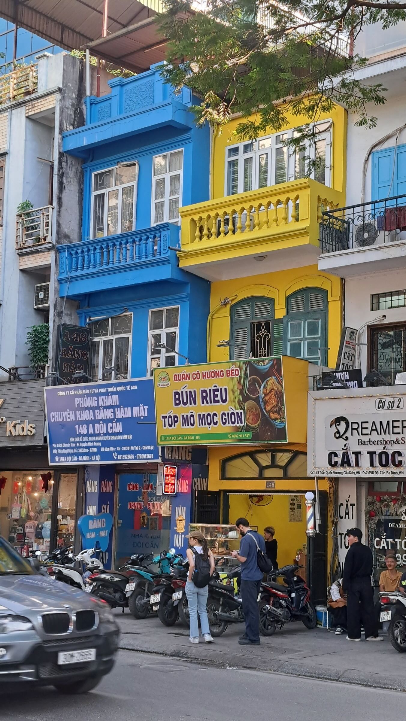
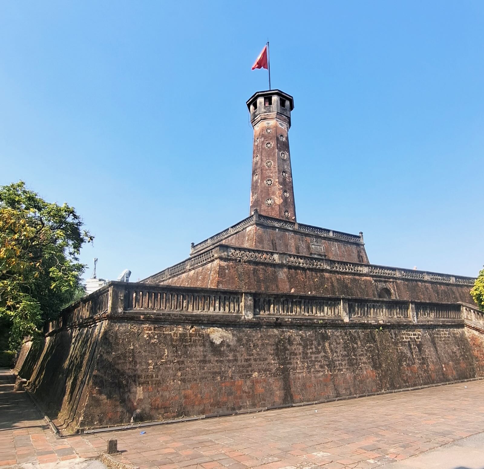


The Answers
Question 01: L – Nha Trang Radio – 7903 kHz recorded at 1205 UTC on 21 January 2026 in Kota Kinabalu, Sabah.
Question 02: E – Hai Phong Radio – 7906 kHz recorded at 1205 UTC on 17 November 2025 in Taal, Philippines.
Question 03: F– Ho Chi Minh Radio – 7906 kHz recorded at 1305 UTC on 08 January 2026 in Chiang Mai, Thailand
Question 04: I – Hue Radio – 7906 kHz recorded at 2250 on 07 January 2026 in Chiang Mai, Thailand
Question 05: D– Da Nang Radio 7906 kHz recorded at 1235 UTC on 08 January 2026 in Chiang Mai, Thailand
Question 06: J – Kien Giang Radio 7906 kHz recorded at 1020 UTC on 18 November 2025 in Taal, Philippines
Question 07: K – Mong Cai Radio 7906 kHz recorded at 1320 UTC on 18 November 2025 in Taal, Philippines
Question 08: A – Ben Thuy Radio on 7903 kHz at 0835 on 04 December 2025 in Trang An, Vietnam
Question 09: M – Phan Rang Radio on 7906 kHz at 1335 on 18 November 2025 in Taal, Philippines
Question 10: O – Phu Yen Radio on 7906 kHz at 1120 UTC on 15 February 2026 in Butterworth, Malaysia
Question 11: Q – Thanh Hoa Radio on 7906 kHz at 2205 UTC on 04 February 2026 in Lake Toba, Sumatra, Indonesia
Question 12: R – Vung Tau Radio on 7906 kHz at 1220 UTC on 11 December 2025 in Pakbeng, Laos
Question 13: C– Can Tho Radio on 7906 kHz at 0205 UTC on 08 January 2026 in Chiang Mai, Thailand
Question 14: G – Hong Gai Radio on 7906 kHz at 1105 UTC on 20 January 2026 in Kota Kinabalu, Sabah
Question 15: N – Phan Thiet Radio on 7906 kHz at 1350 UTC on 22 January 2026 in Kota Kinabalu, Sabah
Question 16: P – Quy Nhon Radio on 7906 kHz at 2235 UTC on 20 November 2025 in Taal, Philippines
Question 17: B – Ca Mau Radio on 7906 kHz at 1135 on 19 November 2025 in Taal, Philippines
So how did you do? If you want to save these recordings, note that the Title field in the metadata contains information about when and where the logging was made.
Links
The Vishipel Website. The content is very different between Vietnamese and English. The latter focuses on services that might be needed by foreign vessels in Vietnamese waters, while the Vietnamese is oriented towards the needs of fishing vessels and other small craft.
https://vishipel.com.vn/he-thong-ttdh-viet-nam.htm
A list of all the Vishipel stations, including contact information such as email addresses.
https://www.youtube.com/watch?v=LYbsldXkc_A
This short Vietnamese video is about the station in Phu Yen. It shows the transmitter site and the staff working inside. At the 1:34 mark, there is a young lady reading a message about a missing fishing vessel (per Google Translate).
https://www.youtube.com/watch?v=XcaaKPoo5Ro?si=Y6Xyp_M8TDUM-i9w This short Vietnamese video is about the ViFish24, a safety monitoring device for fishing vessels.
Thanks for the great article, Don. I was able to hear a couple of these tonight at 0050 and 0105 UTC on 7906 kHz by listening on a KiwiSDR in northern Thailand. The Ho Chi Minh station started up about 30 seconds late with a series of several tones, before making the announcements three times as you have outlined. 73, Dan Greenall
Wonderful, detailed article Don. You did excellence again!
Cheers, Jock
Something new to monitor and worth spending time with radios. Thanks for sharing so much details I never knew existed.
Thanks de Satyan VU3MES