Tag Archives: Maritime Broadcasts

The Giant Antennas of Shanghai Coast Radio Station (XSG)

Many thanks to SWLing Post contributor, Michael (BD4AAQ) who shares the following guest post:


Shanghai Coast Radio Station (XSG):

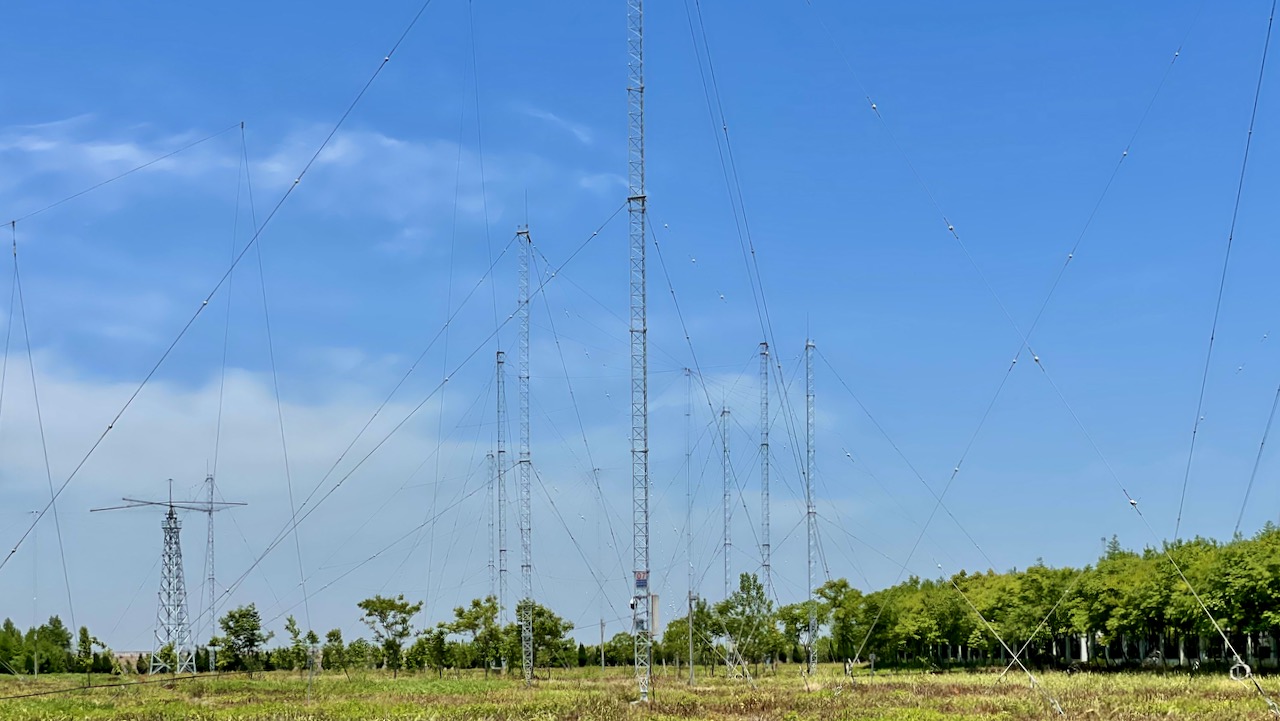
Those Giant Antennas!

The 17th of May is the World Telecommunication Day. It is also the open day of Shanghai Coast Radio Station. On this day, a group of amateur radio operators were invited to visit the transmission facility, a huge antenna farm, of the radio station, located on Chongming Island of Shanghai, the third largest island in China.

Google Satellite Photo

The transmission site of Shanghai Coast Radio Station is as shown below in the map of Chongming Island. Other sites of the station include a central control/receive station in Zhangjiang, a receive station on Hengsha Island and some VHF base stations in a number of other locations. All these locations in Shanghai, linked via cable and microwave connection, form Shanghai Coast Radio Station, also known by its callsign as XSG.

(Google map of transmitter location for Shanghai Coast Radio Station. Note the antenna farm on the left.)

Presentation by Station Officials

Fifteen or so local hams were cordially invited to have a tour of the station. The radio enthusiasts were greeted by station representatives, including Mr Wan, Mr Wang, Mr Zhou and Mr Niu (BH4BFS), who also gave them an overview of the coast radio station’s history and development. 

Antenna Farm

Mr Wang then showed the visitors around the antenna farm. Many of us, myself included, saw and were deeply impressed with these huge antennas for the first time! Indeed, many professional radio facilities and operators of similar coast radio stations work quietly around the globe and around the clock to provide for distress, navigational, business and personal communications needs of ships!

[Click on images to enlarge.]

The antennas cover a wide range of frequencies, from MF, HF, to VHF and UHF. Many of them are, however, shortwave (HF) antennas.

Transmitter Room

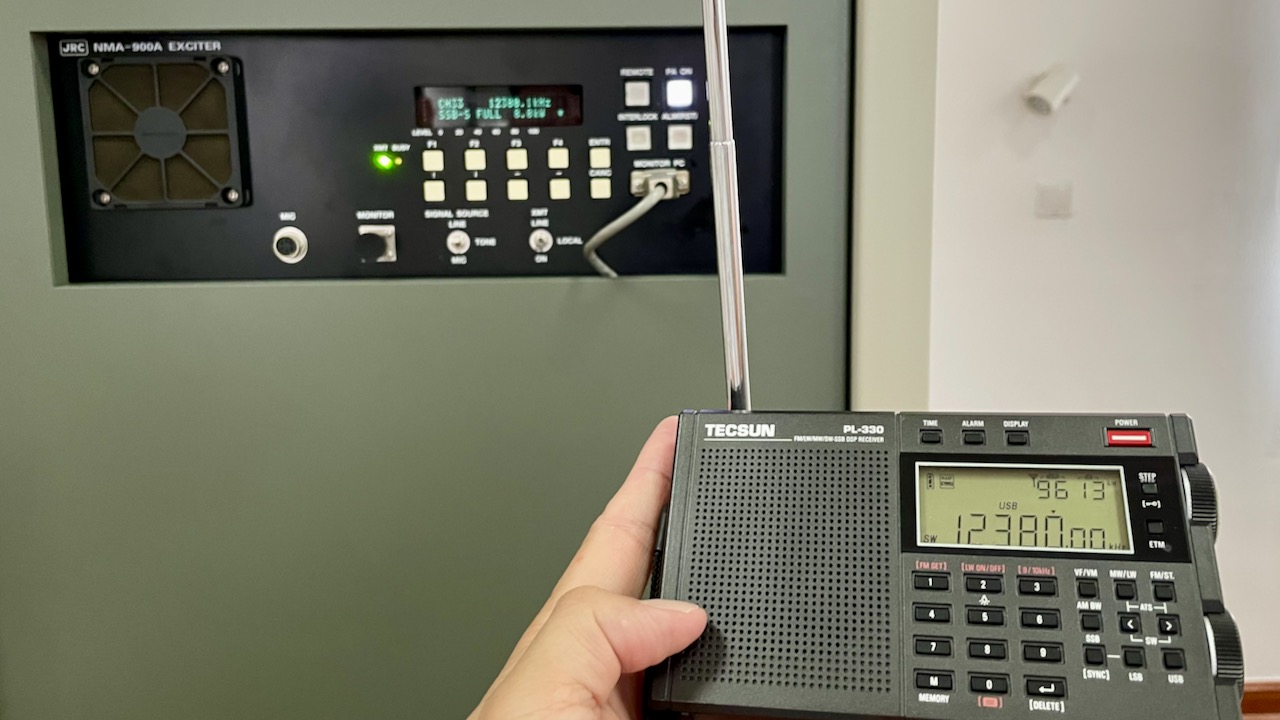
(I placed a Tecsun PL-330 radio near the transmitter at 12380.1 kHz (weather fax). The signal strength, in dbu, is 96. Given the margin of error of the receiver’s display, that’s probably as high as it could go.)

Shanghai Coast Radio Station (XSG) operates on a wide range of frequencies. Its HF frequencies include 4207.5, 4209.5, 4215.5, 4369, 6312, 6326, 6501, 8414.5, 8425.5, 8770, 8806, 12577, 12637.5, 13176, 13188, 16804.5, 16898.5 and 17407 kHz. Of particular note is that they have kept a CW frequency of 8665 kHz for general broadcast of information on a 24 hour basis.

The station’s VHF phone service covers 25 nautical miles of the coast. Its MF NAVTEX covers 250 nautical miles of the coast. And its HF phone and weather fax and HF NAVTEX extend to 1,000 nautical miles.

History and Current Status

Founded in 1905, Shanghai Coast Radio Station has been around 119 years. The XSG callsign has since remained in use.

China has in place DSC watch and NAVTEX broadcast in coast stations (including XSG) in accordance with GMDSS requirements. Among services provided by XSG are Radio Telephony (RT), Narrow Band Direct Printing (NBDP), “Voice of the East China Sea Coast” (voice broadcast on 161.600 MHz and 8806 kHz) and marine radio weather fax. The station is without a doubt one of the largest coast radio stations in the Asia Pacific region and plays an essential role in the region’s marine safety and communications.
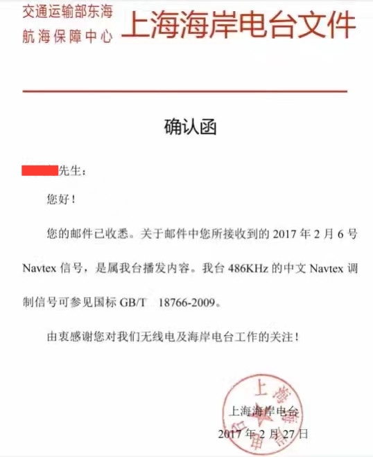
QSL Cards

Shanghai Coast Radio Station issues QSL cards in Chinese and English, traditionally in paper form and nowadays electronically.

(This is an electronic QSL card issued to a Shanghai listener, who received their signal over the radio. Examples of QSL cards in English can be found online.)

Show Room

[Click on images to enlarge.]

Ham Station

Mr Niu of Shanghai Coast Radio Station, one of the tour’s organisers, is a ham himself with callsign BH4BFS. According to him, there are intentions to start a ham radio station within the establishment, possibly incorporating the letters XSG. However, there is much work to be done to make it happen. An amateur radio station with overlapping callsigns with a professional one would be really charming.

Spread the radio love

Coast Guard considers dropping radio-based NAVTEX system

Many thanks to SWLing Post contributor, Tracy Wood, who shares the following article from Alaska Public Media:

For decades, the Coast Guard’s NAVTEX towers have broadcast from Cape Cod to Kodiak Island. The global system broadcasts weather and safety information to boats large and small.

The International Maritime Organization developed the NAVTEX system decades ago as a means to get weather and urgent information to ships on the water. It’s low-tech. Receivers spit out basic telex-type messages onto paper or on a screen.

“The most common thing that you would see is a weather message, but you will also get public safety information messages,” said Derrick Croinex, the Coast Guard chief of spectrum management and telecommunications.

“We need to replace it because the infrastructure is old and it’s failing,” Croinex said.

But before the federal government commits to an expensive upgrade, Croinex said it wants to gauge how vital the service really is.

Right now, the International Maritime Organization is working on upgrading the text-only NAVTEX system to something called NAVDAT. The new system will include images and graphics. And when that system is ready, larger vessels will be required to upgrade to it.

But not if the Coast Guard phases out these radio-based systems completely.

“Our view is, it may be better and more reliable for people to actually switch to satellite,” Croinex said.

But some mariners are urging the Coast Guard to keep the free, low-tech service rather than switch over to subscription-based satellites.[…]

Click here to read the full article at Alaska Public Media.

As Tracy also noted, NAVTEX is great because with a simple soundcard, SSB radio and text decoder you can grab the service reliably.

Thanks for sharing, Tracy!

Spread the radio love

How to decode maritime broadcasts in RTTY, Sitor B, and NAVTEX

(Photo Credit: NOAA)

(Photo Credit: NOAA)

Many thanks to SWLing Post contributor, Mario Filippi (N2HUN) for the following guest post:


Maritime Broadcasts in RTTY, Sitor B, and NAVTEX.

By Mario Filippi, N2HUN

(All photos below are courtesy of the author. Click each image to enlarge.)

Non-voice high seas weather broadcasts and safety messages to mariners can be found by spinning your VFO dial to 8.472 MHz USB courtesy of WLO from Mobile, AL, which provides these transmissions continuously. Here on the East Coast it is received with regularity due to it’s strong signal.

Those of you who are neophytes to RTTY or just want to dabble then this is the place to be to try your hand at an old and venerable digital mode. The RTTY (RadioTeleTYpe) parameters used by WLO transmissions are 45.45 bauds, 170Hz shift. These are most commonly used by amateur radio ops too. If you’ve roamed the bands for RTTY signals you’ll find that most are encrypted with a few exceptions, one of which is WLO which is transmitting continuously.

Tabletop SW radio set to WLO; SignaLink USB links radio to computer for decoding.

Tabletop SW radio set to WLO; SignaLink USB links radio to computer for decoding.

On 8.472 MHz you’ll receive weather information from different latitude/longitudes, along with other pertinent information to mariners such as high seas pirates (not radio pirates!) and naval maneuver areas that are important for ships to avoid. It makes for interesting copy.

To decode RTTY signals you’ll need a shortwave receiver with a BFO (Beat Frequency Oscillator), a way to pipe your radio’s audio into your computer’s sound card, and decoding software. There are several RTTY software packages out there, free, and my favorite is MMTTY. More info on MMTTY is at: http://hamsoft.ca/pages/mmtty.php . Old timers will find this software a snap to use, but newcomers will have to fiddle with the controls to get the decoding going. Below is a snapshot of MMTTY decoding a typical weather broadcast.

MMTTY dashboard with WX info. Cross-like indicator on upper right aids in tuning signal.

MMTTY dashboard with WX info. Cross-like indicator on upper right aids in tuning signal.

Another software available for decoding RTTY is Fldigi. Again, you’ll have to input the correct RTTY parameters such as baud rate and shift into the program along with adjusting your VFO carefully. It takes practice, but when the decoding is successful you’ll see Fldigi doing it’s thing as shown below. Both MMTTY and Fldigi have waterfalls displaying a visual image of the received signal. With practice you’ll be able to distinguish the different common RTTY shifts just by looking at the waterfall.

Fldigi in action with split screen; RTTY text above, waterfall below.

Fldigi in action with split screen; RTTY text above, waterfall below.

Now to Sitor B (Simplex Teletype Over Radio Mode B), another non-voice mode we can use to decode WLO transmissions. Sitor B sounds a lot like RTTY to the human ear, but requires different decoding software. WLO transmits weather information via Sitor B immediately after RTTY transmissions, switching back and forth, which makes for even more fun! Software that decodes Sitor B is available on the ‘Net as free downloads. One is MultiPSK, the other is YaND.

I like YaND (Yet another Navtex Decoder) which is used to decode NAVTEX (Navigational Telex) transmissions commonly found on 490 KHz and 518 KHz, but it works well for decoding Sitor B. There is a difference in the way messages are processed in NAVTEX versus Sitor B and for further information perform a Google search. But the fastest and easiest way to decode Sitor B transmissions from WLO is to fire up YaND. Below is a recent NAVTEX HF broadcast capture.

WLO HF WX broadcast for NE Gulf on 1/18/16 .

WLO HF WX broadcast for NE Gulf on 1/18/16 .

Well, hopefully some of you will be inspired to check out maritime weather/safety information found on WLO using RTTY/Sitor B/NAVTEX software. However, RTTY can also be found on the ham bands and on shortwave frequencies. Several RTTY stations from Germany are found on frequencies such as 11.039MHz and 14.467MHz. Their weather information format is quite different and will give you an idea of European weather conditions and allow you to practice your German. When not sending weather info they run a RTTY message loop below at 50bauds/425Hz shift.

German RTTY station with message loop. Deciphered via MultiPSK.

German RTTY station with message loop. Deciphered via MultiPSK.

In closing, make sure to also check out the NAVTEX broadcasts found just below the AM broadcast band on 490 and 518 KHz; using YaND or MultiPSK you’ll be able to receive these transmissions, but remember you’re not on HF, you are on MW (medium wave), where signal distances are shorter and present a greater reception challenge. YaND software has a NAVTEX broadcast schedule built in as seen below; you have to identify your specific NAVAREA or navigational area, then look at the times and frequencies to determine when to listen in. My QTH is in NAVAREA 4. Lots of interesting information is passed in these NAVTEX transmissions so listen in and have fun!

YaND NAVTEX schedule for various NAVAREAS.

YaND NAVTEX schedule for various NAVAREAS.

NAVTEX on 518 KHz from station VAR-9, New Brunswick, CAN. Messages begin with “ZCZC.”

NAVTEX on 518 KHz from station VAR-9, New Brunswick, CAN. Messages begin with “ZCZC.

Mario Filippi (N2HUN), is the author of this post and a regular contributor to the SWLing Post. Click here to read Mario’s guest posts.

Spread the radio love