 Many thanks to SWLing Post contributor, Ulis (K3LU), who notes that today is the annual Armed Forces Day Crossband Test.
Click here to download a PDF document with all details including frequencies, schedule, and QSL info. Thanks for the tip, Ulis!

 Many thanks to SWLing Post contributor, Ulis (K3LU), who notes that today is the annual Armed Forces Day Crossband Test.
Click here to download a PDF document with all details including frequencies, schedule, and QSL info. Thanks for the tip, Ulis!
Many thanks to SWLing Post contributor, Giuseppe Morlè (IZ0GZW), who shares the following guest post:
by Giuseppe Morlè (IZ0GZW)
Ciao Thomas and Friends at the SWLing Post!
This is the summary of 3 days of testing of my Icom IC-705 just purchased and immediately taken to Ponza Island, my hometown, for a full immersion DXpedition only listening to amateur radio bands especially on 20 m.
I left Formia on the ship that went to Ponza and it was not a good start given the adverse sea weather conditions. After 3 hours of crossing in the rain and the strong sirocco wind, I arrived on the island at my father’s house.
In the early afternoon in the rain, I hoisted a 20 meter row on the “sloper” type roof not so high from the ground and connected directly to the Icom 705 without any counterweight given the place without electrical noise.
The position of my father’s house is open from West to North but totally covered to the South by a hill of 200 meters …
In this video you can see all of this:
During the first night, 20 meters was full of signals especially from the USA; it was, in fact, what I had hoped for given the position open to the West.
Really good overseas signals despite bad weather … below is a series of mixes of North American stations: Continue reading
By Brian D. Smith, W9IND
A journey of a thousand miles begins with a single step, as the proverb goes, and the road to a 2022 W9IMS Checkered Flag Award begins with a single QSO – or a single SWL reception.
W9IMS will stage special event stations commemorating each of the three major races at the Indianapolis Motor Speedway this year: the Grand Prix, the Indianapolis 500 and the NASCAR 200 at the Brickyard.
Your weeklong opportunity to complete the first of three required contacts with W9IMS starts Sunday, May 8, and ends at 11:59 p.m. Saturday, May 14 (0359 UTC Sunday, May 15). The special event schedule will resume only 8 days later with the Indy 500 operation (May 23-29), followed by the NASCAR 200 from July 25-31.
Individual QSL cards accompany each of the three events, and a Checkered Flag certificate awaits those who bag the trio. Hams and SWLs alike may apply for the cards and certificate; see www.w9ims.org for further information.
Where to find W9IMS? The station fires up on 20- and 40-meter General Class frequencies, usually on or near 14.245 and 7.245 MHz. But the easiest way to locate W9IMS is to check DX spots, especially on DX Summit at http://www.dxsummit.fi/
Type “W9IMS” in the search box at upper right and you’ll see which, if any, frequencies the station is currently occupying. Note that special event operations are not continuous throughout the week, but you’ll find scheduled times and operators on the W9IMS QRZ page – and there’s always the possibility of unscheduled appearances by operators with an hour or two to spare.
Any hour of the day or night is fair game, but the surest way to catch W9IMS is during prime time: weekdays from 6 to 10 p.m. Indy time or 2200 to 0200 UTC. And if all else fails, listen for happy hour – the last blast on Race Day (May 14 for the Grand Prix), usually starting at 11 p.m. Indy time or 0300 UTC. That’s when W9IMS ops traditionally switch to contest-style QSOs, exchanging only signal reports, to put as many stations in the log as possible.
Don’t stake your certificate on any announced schedule, however; W9IMS on-air times can be curtailed by adverse solar or weather conditions or a paucity of QSOs.
Likewise, the station has been known to activate an unannounced band, such as 80 meters, at the drop of a hat. Again, DX Summit and other DX spotting networks are your best friend in this regard.
Feel free to submit all of your 2022 QSL and certificate requests in the same envelope, and if you don’t have a QSL card, a printout of your W9IMS contacts or reception reports will suffice.
Many thanks to SWLing Post contributor, Giuseppe Morlè (IZ0GZW), who shares the following:
Dear Thomas,
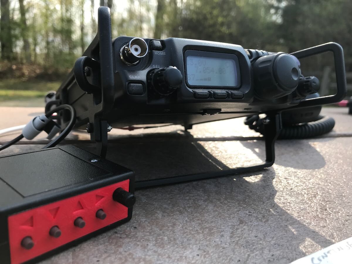
I wanted to share my new purchase with all SWLing Post friends: the Icom IC-705.
It is truly a great portable QRP transceiver and a great receiver for broadcast listening.
In this video, shot on my balcony at home, is the first listening test on short waves. Crystal clear audio with cathedral effect. My portable cross loop antenna pairs very well with the IC-705.
It’s a simple video but it brings out all the listening potential of this 705.
Greetings to you and all the friends of our community.
73,
Giuseppe Morlè (IZ0GZW)
Click here to watch on YouTube.
Thank you for sharing this, Giuseppe! I’ve found that the IC-705 has become one of my favorite portable receivers. It’s truly an amazing radio and, I believe, worth the hefty price tag.
I published a very favorable review of this radio and 13DKA has as well. Also, check out Giuseppe Fisoni’s comparison of the IC-705 and IC-R8600. The IC-705 is a proper enthusiast-grade radio–I would purchase it just for the receiver functionality. Being a ham radio operator, I also take the IC-705 to the field very regularly–I post many of my field reports on QRPer.com. Recently, we’ve posted a number of articles about protecting the IC-705 during travels and in the field.
Thank you again for sharing this, Giuseppe!
Welcome to the SWLing Post’s Radio Waves, a collection of links to interesting stories making waves in the world of radio. Enjoy!
HARARE, Zimbabwe — The unavailability of critical information about community radio in Africa has led the University of the Witwatersrand(Wits) journalism department and a consortium of media, civil rights and business NGOs — Fojo Media Institute, Civicus, Civil Rights Defenders, Defend Defenders and Hub Afrique — to carry out a study entitled “Mapping Community Radio in Sub-Saharan Africa.”
“Even basic information is hard to get, and it is often not even certain how many stations are on air. Operations collapse, and others start, with hardly anybody outside the immediate environment noticing. Even the licensing authorities sometimes struggle to keep accurate records,” revealed Prof. Franz Kruger, head of Wits Journalism.
Conducted by Jacob Ntshangase, the head of Wits Radio Academy, the study sought to gather information and better understand the community radio landscapes in different parts of Sub-Saharan Africa to identify needs, opportunities and potential partners for developing a program of support for community radio on the continent. [Continue reading…]
The 2022 NAB Show is already underway in Las Vegas, and fresh from presenting some new research on HD radio in the US, Xperi SVP Broadcast Radio, Joe D’Angelo (pictured), sat down with radioinfo’s Wayne Stamm.
Joining the conversation was Commercial Radio Australia’s Head of Digital, Jamie Chaux, to add an Australian perspective and view on what might be gained from the HD experience in the States.
radioinfo: We’re talking about a couple of the presentations that are going to be made at NAB this year. Joe you’ve already done one of those presentations and taken a look at some very interesting studies that have been done recently about the penetration of HD radio, especially here in the US.
Joe D’Angelo: Yes, I finished a session today on actually UX guidelines (NABA Radio In-car User Experience) for in-car receiver design and that that went very well. And what’s really exciting about not only the work of the UX group, but the progress of HD radio, is we’re now at 85 million vehicles on the road.
And so we surveyed users of the technology and 91% of them came back and said that HD radio has significantly improved their radio listening experience.
74% of people said they would not buy another new car unless it had HD radio, which is very affirming.
Read more at: https://radioinfo.com.au/news/can-the-hd-radio-experience-be-of-use-in-regional-australia-nabshow/ © RadioInfo Australia
Learning anything new, especially so broad and far reaching as electronics, can be hard. [IMSAI Guy] knows this because he gets asked regularly ‘how do I learn electronics?’ Many of you reading this will have a few ideas to pass along (and we encourage you to share your take on it in the comments below) but there is an even greater number of people who are asking the same question, and [IMSAI Guy]’s take on it is one that this particular Hackaday writer can relate to.
According to [IMSAI Guy], an excellent place to start is the ARRL Handbook. The ARRL Handbook is an electronics and RF engineering guide published by the Amateur Radio Relay League in the US. It’s a wonderful reference, and past editions can be had very inexpensively and are every bit as handy. Many hams will have a copy they could be talked out of, and you can likely find one at your local library. Where to start in the Handbook, then?
[IMSAI Guy] recommend starting with whatever catches your fancy. As an example, he starts with Op Amps, and rather than diving straight into the math of how they work or even worrying to much about what they are- he just builds a circuit and then plays with it to intrinsically understand how it works, a “learn by doing” approach that he has found extremely helpful just as many of us have. We also appreciated is very straightforward approach to the math: Don’t bother with it unless you need to for some reason, and definitely don’t start by learning it first.
Read the full article and watch the video at:
https://hackaday.com/2022/04/25/learning-electronics-by-just-doing-it/
As previously announced, RadCom Editor Elaine Richards, G4LFM is to retire in the summer and there will be a vacancy for a person to edit RadCom, the Society’s journal and one of the most respected amateur radio publications in the world.
The successful candidate will need to show demonstrable experience of producing professional and technical publications in both print and digital formats as they will need to take the entire co-ordinated portfolio forward and exploit new media opportunities.
The role also includes overseeing the publication of RadCom Basics and RadCom Plus with their editors, as well as being part of the team that puts together GB2RS news each week.
The role is being advertised by Redwood Publishing Recruitment and is also on the Guardian Jobs website and LinkedIn. If you’d like an informal chat about the role, please contact the General Manager via [email protected]
All applications must be made via the Redwood website: https://www.redwoodrecruitment.com
Please consider supporting us via Patreon or our Coffee Fund!
Your support makes articles like this one possible. Thank you!
 Many thanks to SWLing Post contributor, Frans Goddijn, who writes:
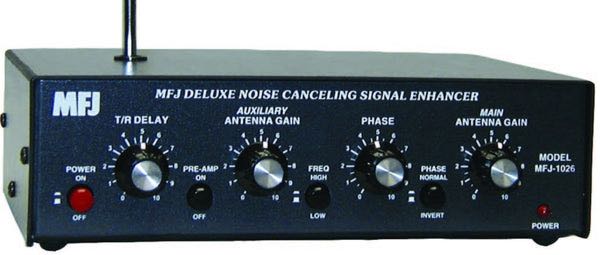
“Last week I purchased the MFJ-1026 ‘noise canceling signal enhancer’ and I posted two blogs with video about it. Initially the device seemed as useless as it is good looking but then I found a configuration where the device is not only pleasant to have but also useful for radio listening.”
Here are Frans’ reports which he kindly shares from these two posts originally published on his blog, Kostverlorenvaart:
Using a GRAHN antenna, (a VENHORST wire antenna for noise reference), the iCOM R8600 radio and optional bhi DSP audio noise canceling, trying to see what’s the best way to cancel noise — on the antenna entry point of the radio or at the speaker output end.
In this case the MFJ-1026 seems ineffective. The DSP at the audio output end works well and easy.
I have also tried two GRAHN antennas on the MFJ-1026, one for MAIN and one for AUX but that was also not noticeably effective yet.
I will also try the little whip antenna that MFJ supplied with the box. Further tweaking may turn out to be helpful on some other frequencies / signals.
Before installing the MFJ i used the little TECSUN H-501x to scan the room for any devices producing radio noise. It turned out that the two Apple Homepods sit in a dense cloud of radio noise, the Macbook Pro also radiates noise, EVE smart plugs controlling lights also produce radio noise, two little label printers s well and the HP printer/scanner too. So I moved those to the other end of the toom or to another room. Continue reading
 Many thanks to SWLing Post contributor, Jock Elliott, who shares the following guest post:
By Jock Elliott, KB2GOM
Here’s a shocker for you: we live at the bottom of the sky. Above us there are multiple layers of the atmosphere, pressing down on us at 14.7 pounds per square inch.
Of particular relevance to us as shortwave listeners and hams, there is a special layer of the atmosphere, not shown on the chart above called the ionosphere. The ionosphere starts around 30 miles above us and extends up to about 600 miles and includes parts of the layers above.
The Sun’s upper atmosphere, the corona, is very hot and produces a constant stream of Ultra-Violet and X-rays, some of which reach our atmosphere. When the high energy UV and X-rays strike the atmosphere, electrons are knocked loose from their parent atoms and molecules, creating a layer of electrons.
Now, here’s the cool part: this layer – the ionosphere – is important because radio waves bounce off of it.
The sun, however, is not constant in its action on the ionosphere. The amount of UV and x-ray energy (photon flux) produced by the sun varies at by nearly a factor of ten as the sun goes through an 11 year cycle. The density of the ionosphere changes accordingly, and so does the ability of the ionosphere to bounce radio waves. When the sun is at peak activity, and the ionosphere is “hot,” SWLs and hams are likely to experience excellent long-range propagation. When the sun is quieter, long-range propagation diminishes.
Every 11-year solar cycle is unique, but early indications are that we may on the verge a cycle that favors long-range propagation: https://swling.com/blog/2022/03/termination-event-may-indicate-solar-cycle-strength/
The results can be spectacular. Decades ago, during a particularly hot solar cycle, I once spoke from my station near Albany, NY, to a station in the state of Georgia on a mere 4 watts. On another occasion, I conversed with a ham in Christchurch, New Zealand – a distance of over 9,000 miles – with 100 watts single sideband transmit power. During that same period, I would routinely listen to shortwave stations halfway around the world.
And now, it’s your turn – what’s your favorite long-range propagation story, either as an SWL or ham? Please comment!